
With the rapid development of the aviation industry, the airport, as an important transportation hub, its security is particularly important. According to the statistics of ICAO, there are more than 20,000 incidents of "birds colliding with planes" around the world every year. The International Aviation Federation listed the "bird collision" as a Class A aviation disaster. Recently, two serious air crashes occurred in turbulent Russian airspace and economically developed South Korea, especially the crash of Boeing 737-800 at South Korea's Wu 'an International Airport, which became the focus of attention.

As a common biological group in nature, the low-flying activities of birds also pose a threat to airport safety that cannot be ignored. The impact of birds on aircraft is a major hidden danger in the field of aviation safety. Bird strike may cause damage to aircraft parts and affect the normal flight of aircraft. In extreme cases, bird strike may even lead to the failure or damage of the aircraft engine, resulting in the loss of power and serious air crash.
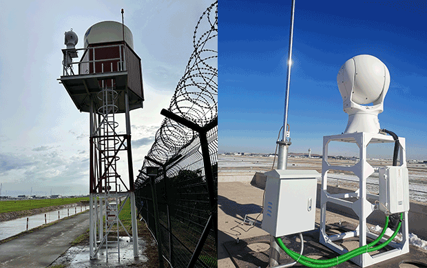
With the rapid development of science and technology, aircraft flight safety monitoring technology is also improving. However, at this stage, the commonly used low-altitude radar monitoring methods in the market have some shortcomings, such as poor precision in the near-air area and large blind area. With the upgrading of airport security management and control, single technical means can no longer meet the market demand. With the help of low-altitude radar, high-precision infrared photoelectric monitoring equipment can be introduced to realize accurate monitoring, identification and tracking of low-altitude targets, effectively making up for the shortcomings of single technology.
System introduction:
Hope-wish low-altitude safety management and control system adopt technologies such as high-precision servo tracking, artificial intelligence neural network and long-distance and long-focus precision focusing based on radar guidance data to provide users with effective real-time video images, real-time intelligent target identification results and full-process video recording.
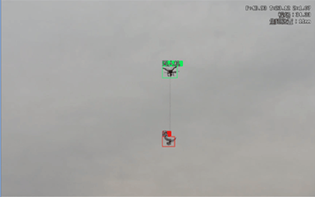
Target classification recognition effect
The system has the characteristics of all-weather, long monitoring distance, clear image, excellent tracking performance, high intelligence and simple operation. It can automatically monitor the flight situation of low-slow and small targets such as drones and birds in the area where the system is deployed, and report the suspected targets in real time and accurately locate and track them. The comprehensive interception method of various means is adopted to avoid secondary damage caused by target interception and realize safe interception, which can meet the needs of key areas, airports, prisons and large-scale enterprises.
System functions:
(1) High-definition visible camera is used in daytime to realize accurate identification and tracking of "low, slow and small" targets such as drones and birds;
(2) At night or under the condition of low visibility, infrared thermal imager is used to realize accurate identification and tracking of "low, slow and small" targets such as drones and birds;
(3) Automatic recognition of "low, slow and small" targets such as drones and birds is realized through artificial intelligence image recognition technology;
(4) The rotation of the equipment can be controlled manually or according to the program, and the focal length can be controlled manually or automatically according to the target size;
(5) Capture the flight state of birds and other targets by high-definition high-frame camera, and locate the precise position of birds and other interfering targets.
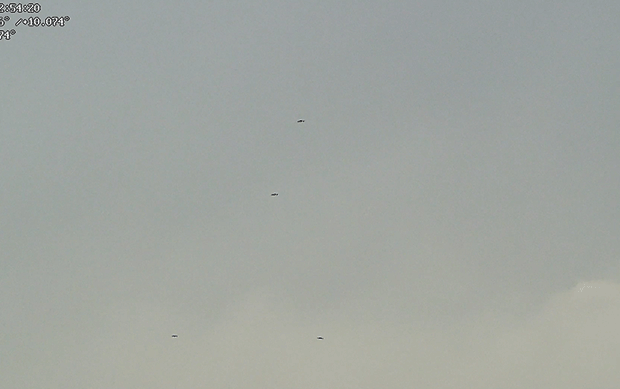
Visible light-UAV group
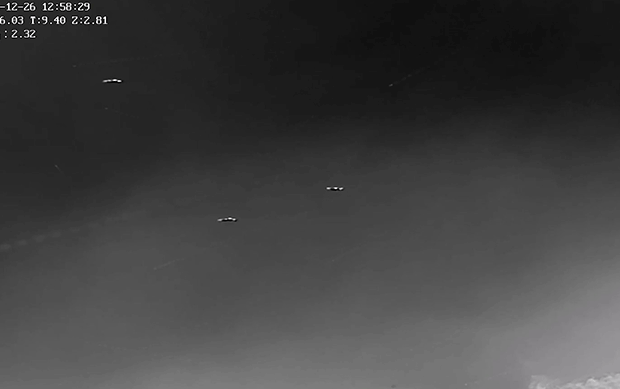
Infrared thermal imaging-UAV group
System features:
(1) excellent tracking performance
The image intelligent processing part of the system adopts advanced algorithms, focusing on the adaptive calculation of automatic tracking when the complex background and background changes, maintaining stable tracking when the trajectory of unmanned aerial vehicle or bird changes sharply, and also having excellent tracking ability when tracking long-distance targets, which can track and identify targets continuously and stably in the process of continuous maneuvering.
(2) High intelligence.
Through the exploration and research of neural network technology, the tracking of airborne objects such as drones, birds and balloons and the identification of various targets are realized. At present, through a large number of low-altitude target data collection, labeling and algorithm research, an algorithm model for low-altitude target recognition has been trained, and the model has been preliminarily tested and verified, which can identify low-speed and small targets such as drones, birds, balloons and kites.
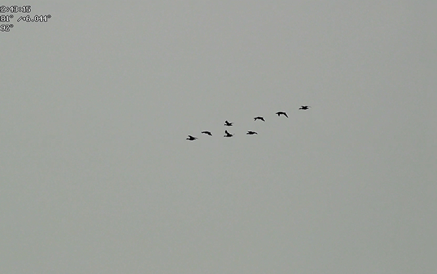
Visible light-birds
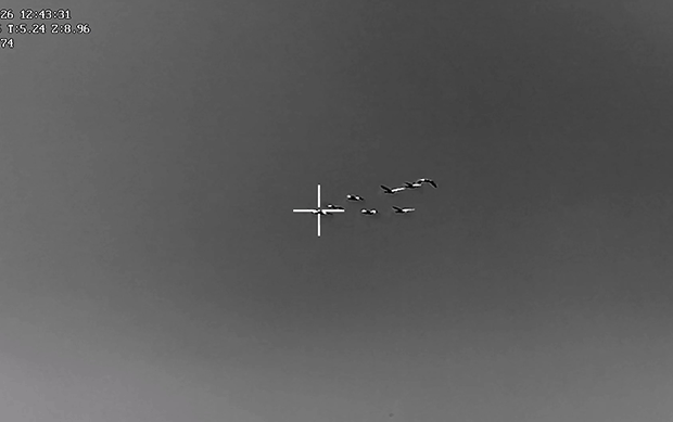
Infrared thermal imaging-birds
At present, Hopewell's low-altitude safety management and control system has been widely used in the aviation field. It has obtained mature application cases in Hong Kong International Airport, Guangzhou Baiyun Airport, Xi 'an Xianyang Airport, Tibet Longzi Airport, Harbin Taiping International Airport and other large international airports. At the same time, it has been widely used in low-altitude prevention and control in key areas of key cities in China, such as Beijing, Shanghai, Shenzhen and Qingdao, which has injected strong impetus into the high-quality development of low-altitude economy throughout the country and provided a strong guarantee for the safe and stable development of low-altitude areas.